What the Ocotillo Road bridge project means for Gilbert, AZ |
The Greenfield-to-Higley extension adds an east–west connection and a pedestrian crossing near Gilbert Regional Park |
Look at a map of south Gilbert and the space between Greenfield and Higley roads explains why a relatively short section of Ocotillo Road needs several bridges.
A canal, a floodway, a regional basin and a wash sit along the route.
Gilbert’s Ocotillo Road extension will carry the road through that gap and give drivers another east–west connection near Gilbert Regional Park once the route opens.
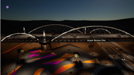
The crossing closest to the park is also designed with people on foot in mind.
Construction photos released by the town show an arch going into place on the pedestrian crossing and a lookout deck fitted with shade structures.
The contractor describes a 264-foot steel arch bridge as the centerpiece of the job.
The road and pedestrian elements give the project two uses at the same site: a connection across south Gilbert and a place to pause and look out over the park area.
Four crossings along one route
The larger job includes three bridges for vehicles and a box culvert at the Roosevelt Water Conservation District Canal.
Gilbert’s design materials identify the other crossings at the East Maricopa Floodway, the Chandler Heights Regional Basin and Queen Creek Wash.
The box culvert was built in an early phase in 2023, ahead of the broader construction effort.
The bridge over the basin will span an area identified for a future phase of Gilbert Regional Park.
That geography helps explain why progress on a visible arch tells only part of the story.
Crews also have to complete the crossings and make the pieces work together as a through route.
The town’s August 27 construction update reported utility work from Regional Park Drive toward Banning Street, a less visible part of the same job.
The town puts the total investment at $112 million and says the Town Council approved it in June 2024.
What to look for as construction wraps up
The project page gives a construction window from summer 2024 to fall 2026.
For a driver who wants to use the new connection, the important milestone is an official opening to regular traffic.
The published construction window describes the project timeline, so look for a separate opening announcement and follow posted signs before changing an everyday route.
The town’s project page lists a hotline at 480-898-4090 for construction questions.
For people interested in the pedestrian crossing, the lookout deck and shade are the features to watch.
A crossing that gives people room to stop offers a different experience from walking along a road solely to get from one side to the other.
Gilbert says more than 6,000 residents weighed in on the design, and the crossing was planned as a gateway to the 272-acre regional park.
The basin below the bridge is tied to the park’s future plans, so updates on that work are worth following separately.
If the project is part of your daily drive or your plans for a park visit this fall, start with the town’s construction updates and its drawings of the crossings.
The new route is meant to connect two familiar roads, and the maps show exactly where the connection sits in relation to the waterways and the park.
For now, keep using signed routes and check the town’s opening information before planning a trip across the new span. |
0 Comments
Join the conversation
Be the first to comment
Share your thoughts above.